
On The Trail of the Okies
Trying to Find That Groove
After Arcadia, Oklahoma, the route starts becoming urban as you are approaching Oklahoma City from the east.
Saturday, October 20, 2012 13:48:46
Saturday, October 20, 2012 13:48:46
 |
| Oklahoma countryside southwest of Arcadia, Oklahoma on Route 66 |
East of Edmond, route 66, which has been taking you on a southwesterly course, bends to the west and becomes Edmond road. You cross under I-35, and are in the Oklahoma City suburb of Edmond.
Saturday, October 20, 2012 14:02:27
Saturday, October 20, 2012 14:02:27
 |
| Route 66 becomes a suburban strip road in Edmond, Oklahoma |
You take a left in Edmond on South Broadway. You are now heading south.
Saturday, October 20, 2012 14:02:54
Saturday, October 20, 2012 14:02:54
 |
| Turning on South Broadway to follow the route. |
Saturday, October 20, 2012 14:03:26
 |
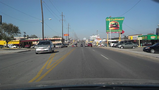
| Wataburger at East 5th and Route 66/South Broadway in Edmond, Oklahoma |
 | ||
| Red Carpet Motel on Route 66 in Edmond, Oklahoma
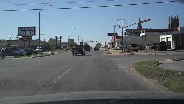
As you head south, then southwest, the route turns into interstate (Broadway Extension Highway). The GPS tried to tell us to make a u turn somewhere here. However, in the traffic, we either missed it or it wasn't there. I would recommend either taking the East Memorial road interchange exit (which is probably labeled North Kelly Avenue). Make a left on North Kelly, and you will be heading south. We ended up going to the northwest 122nd street exit and following the cloverleaf ramps around until we got back in the northbound lanes. Yes, that's right, we were somewhat lost. We took the next exit to North Kelly Avenue and headed south. This could be avoided if you don't miss the exit. However, I could've taken 122nd street east to North Kelly and turned right to get south. The last time we were here we got lost too. This is tricky poorly marked section in an area that badly needs more signage to keep you on the route. There is a cemetery there with an interesting wall made up of what looks like scrap building material.
Memorial Park Cemetery
After we got ourselves lined up on the right route, we were more cautious about directions. We headed south on North Kelly until we hit the I-44 onramp (gulp). We weren't on it for long as it took us west then south over a mix master interchange onto North Lincoln Boulevard. Here, the Oklahoma capitol building comes into view.
|

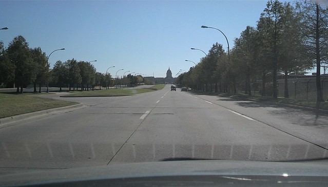 |
| Oklahoma Capitol building as viewed from the southbound lanes of Lincoln Boulevard/route 66. |
Saturday, October 20, 2012 14:28:12
You take North Lincoln Boulevard south and get in the far right lanes to exit on an interchange on the west side of the Oklahoma State Capitol grounds onto Northeast 23rd street heading west.
View Larger Map
You pass under the Centennial Expressway (I-235, US-77).
Saturday, October 20, 2012 14:31:38
Saturday, October 20, 2012 14:31:44
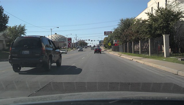
Continue heading west on NW 23rd street, through one of the more interesting neighborhoods in OKC.
Saturday, October 20, 2012 14:32:39
Saturday, October 20, 2012 14:32:50
The gold dome just recently sold in foreclosure. There seems to be a troubling history of preservation efforts. Equally troubling to me are all the chain drug stores that seem to saturate every corner.
Saturday, October 20, 2012 14:32:54
Saturday, October 20, 2012 14:33:00
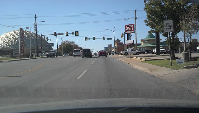
Saturday, October 20, 2012 14:34:42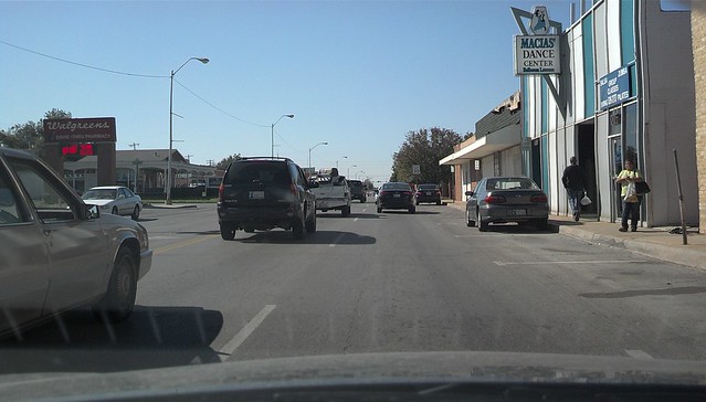
Saturday, October 20, 2012 14:35:12
Continue heading west on NW 23rd, past Oklahoma City University....
Saturday, October 20, 2012 14:38:18
Turn right on North May Avenue, and head north. The next left is NW 39th Expressway which takes you through an interchange and on westward out of Oklahoma City.
Saturday, October 20, 2012 14:39:55
Here the route turns into a nice 4 lane divided boulevard. This is also known as NW 39th Expressway. We followed it to North Lake Overholser Drive, where, for some reason, the gps app decided to take us on a little detour -- possibly a last remaining older alignment of the route. It was a nice short scenic route in the afternoon sun. We passed the lake and under the John Kilpatrick Turnpike. We turned right at North Sara Road. We then intersected North Main Street, also, route 66.
http://en.wikipedia.org/wiki/Fort_Reno_(Oklahoma)
El Reno, OK 73036, USA
The road here is a very long portion of original concrete pavement, complete with curbs, which you do not see on highways these days.
Saturday, October 20, 2012 15:26:16
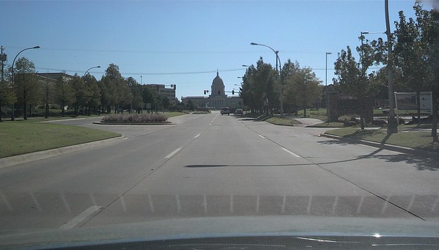 |
| Oklahoma Capitol Building. http://en.wikipedia.org/wiki/Oklahoma_State_Capitol |
View Larger Map
You pass under the Centennial Expressway (I-235, US-77).
Saturday, October 20, 2012 14:31:38
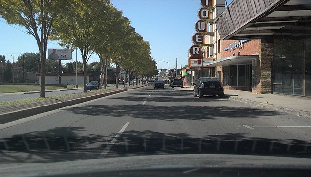
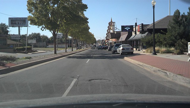 |
| Tower Theater Building, 23rd Street/route 66, Oklahoma City, Oklahoma http://cinematreasures.org/theaters/11609 Here is an excellent blog... http://dougdawg.blogspot.com/2009/09/tower-theatre.html |
Continue heading west on NW 23rd street, through one of the more interesting neighborhoods in OKC.
Saturday, October 20, 2012 14:32:39
Saturday, October 20, 2012 14:32:50
 |
| The Gold Dome http://en.wikipedia.org/wiki/Gold_Dome |
Saturday, October 20, 2012 14:32:54
Saturday, October 20, 2012 14:33:00
Saturday, October 20, 2012 14:34:42
Saturday, October 20, 2012 14:35:12
Continue heading west on NW 23rd, past Oklahoma City University....
Saturday, October 20, 2012 14:38:18
Turn right on North May Avenue, and head north. The next left is NW 39th Expressway which takes you through an interchange and on westward out of Oklahoma City.
Saturday, October 20, 2012 14:39:55
Here the route turns into a nice 4 lane divided boulevard. This is also known as NW 39th Expressway. We followed it to North Lake Overholser Drive, where, for some reason, the gps app decided to take us on a little detour -- possibly a last remaining older alignment of the route. It was a nice short scenic route in the afternoon sun. We passed the lake and under the John Kilpatrick Turnpike. We turned right at North Sara Road. We then intersected North Main Street, also, route 66.
Oct 20, 2012 2:57:23 PM
Yukon, OK 73099, USA
Oct 20, 2012 3:15:42 PM
El Reno, OK, USA
In April, we spent the night in El Reno, and rode out a severe hail storm under a metal awning of a place that sells Fried Pies
The route curves north into El Reno as South Rock Island Avenue. Coming into downtown, a left is made at West Wade Street. Two blocks to the west, a right is made on South Choctaw Avenue (us 81). Drive north about two short blocks to Sunset Drive and make a left. This takes you out of town and towards the west. The route bends towards the highway to the south, and a right is made on East 1020 Road, which is at the entrance to Fort Reno, which the town is named after.
http://en.wikipedia.org/wiki/Fort_Reno_(Oklahoma)


Oct 20, 2012 3:25:48 PM
The road here is a very long portion of original concrete pavement, complete with curbs, which you do not see on highways these days.
Saturday, October 20, 2012 15:26:16
Oct 20, 2012 3:26:12 PM
El Reno, OK 73036, USA
 |
| 1026 Rd (RT 66) West of El Reno, Oklahoma |
Saturday, October 20, 2012 15:32:23
Oct 20, 2012 3:32:39 PM
Calumet, OK 73014, USA
 |
| 1026 Rd (RT 66) West of El Reno, Oklahoma |
Saturday, October 20, 2012 15:33:11

Saturday, October 20, 2012 15:34:35
Oct 20, 2012 3:34:03 PM
Calumet, OK 73014, USA
 |
| 1026 Rd (RT 66) West of El Reno, Oklahoma |
Saturday, October 20, 2012 15:36:48

Oct 20, 2012 3:39:34 PM
Geary, OK, USA
At the intersection of East 1020 road and 281, at a truck stop called Cherokee Trading Post, you turn right and head north west.
Saturday, October 20, 2012 15:41:00
 |
| US 281 (route 66), Oklahoma |
Saturday, October 20, 2012 15:41:26
 |
| US 281 (route 66), Oklahoma |
You take US 281 to Old Us Highway 66. You have rejoined the old concrete section with curbs after driving on 4 lane divided highway. This road is also Jones Road NW.
Saturday, October 20, 2012 15:42:44
Geary, OK 73040, USA
Saturday, October 20, 2012 15:42:44
Geary, OK 73040, USA
 |
| Original concrete paved section of Old US 66 near Geary, Oklahoma. |
Saturday, October 20, 2012 15:43:11
Geary, OK 73040, USA
Geary, OK 73040, USA

Saturday, October 20, 2012 15:43:19

At the T intersection of James Road NW and Oklahoma 8, (also Us 281) you take a left.
Saturday, October 20, 2012 15:44:40
Geary, OK 73040, USA
Saturday, October 20, 2012 15:44:40
Geary, OK 73040, USA

Saturday, October 20, 2012 15:45:20
Geary, OK 73040, USA
A famous route 66 landmark known as the pony bridge, or the Bridgeport camelback pony bridge over the South Canadian River, is crossed.
http://www.okladot.state.ok.us/hqdiv/p-r-div/spansoftime/camelbackpony.htm
Geary, OK 73040, USA
A famous route 66 landmark known as the pony bridge, or the Bridgeport camelback pony bridge over the South Canadian River, is crossed.
http://www.okladot.state.ok.us/hqdiv/p-r-div/spansoftime/camelbackpony.htm
 |
| Bridgeport Camelback Pony Bridge taking route 66 over the South Canadian River in Oklahoma |
Saturday, October 20, 2012 15:45:25
Geary, OK 73040, USA
Geary, OK 73040, USA

Saturday, October 20, 2012 15:45:33
Geary, OK 73040, USA
Geary, OK 73040, USA

Saturday, October 20, 2012 15:45:35
Geary, OK 73040, USA
Geary, OK 73040, USA

Saturday, October 20, 2012 15:45:44
Geary, OK 73040, USA
Geary, OK 73040, USA

Saturday, October 20, 2012 15:46:03
Geary, OK 73040, USA
Geary, OK 73040, USA

The road had been traveling to the southwest, now, after crossing the pony bridge, the road bends west.
Saturday, October 20, 2012 16:03:01
Hydro, OK 73048, USA
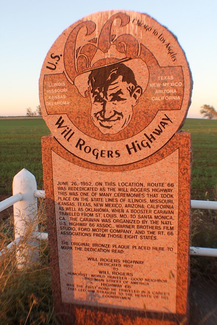
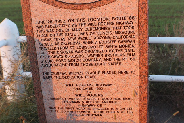
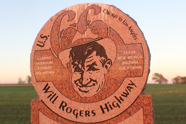
Another famous Route 66 landmark is passed. Like so many landmarks on this route, this one isn't outstanding because of the scenery so much as it is because of the history, and more importantly, the person behind that history. This is the home of the "mother of the mother road," Lucille.
http://amhistory.si.edu/onthemove/exhibition/exhibition_10_4.html
A roadhouse to the west is named after Lucille Hammons
http://lucillesroadhouse.com/about-us
http://en.wikipedia.org/wiki/Lucille_Hamons
Saturday, October 20, 2012 16:03:01
Hydro, OK 73048, USA
Another famous Route 66 landmark is passed. Like so many landmarks on this route, this one isn't outstanding because of the scenery so much as it is because of the history, and more importantly, the person behind that history. This is the home of the "mother of the mother road," Lucille.
http://amhistory.si.edu/onthemove/exhibition/exhibition_10_4.html
A roadhouse to the west is named after Lucille Hammons
http://lucillesroadhouse.com/about-us
http://en.wikipedia.org/wiki/Lucille_Hamons

Saturday, October 20, 2012 16:03:04

Hydro, Oklahoma
It is about here that you start seeing Route 66 become more of an outer road to the highway, I-40.Saturday, October 20, 2012 16:06:18

We are coming into Weathorford, Oklahoma, which is the center of a huge windmill area.
http://cityofweatherford.com/
http://en.wikipedia.org/wiki/Weatherford,_Oklahoma
We passed Lucille's Road House.
http://lucillesroadhouse.com/
Here the outer road is East Main Street. East Main Street swings off to the left and as you follow the route straight, you are now on East Davis Avenue. At North Washington Avenue, we turned left towards the south, then made another left back on East Main Street.
- 2012/10/20 Saturday 16:15
Oct 20, 2012 4:07:05 PM
Weatherford, OK 73096, USAhttp://cityofweatherford.com/
http://en.wikipedia.org/wiki/Weatherford,_Oklahoma
We passed Lucille's Road House.
http://lucillesroadhouse.com/
Here the outer road is East Main Street. East Main Street swings off to the left and as you follow the route straight, you are now on East Davis Avenue. At North Washington Avenue, we turned left towards the south, then made another left back on East Main Street.
- 2012/10/20 Saturday 16:15
Phillips 66
My Location@16:15,10/20
125-153 S Washington Ave, Weatherford, OK 73096
Saturday, October 20, 2012 16:30:36
 |
| Weathorford, Oklahoma |
Saturday, October 20, 2012 16:30:39
 |
| Weathorford, Oklahoma |
Saturday, October 20, 2012 16:30:43
 |
| Weathorford, Oklahoma |
Saturday, October 20, 2012 16:30:49
 |
| Weathorford, Oklahoma |
Saturday, October 20, 2012 16:30:58
 |
| Weathorford, Oklahoma |
Take West Main Street to South 4th Street and turn left heading south on 54. This bends to the west and becomes an outer road again for I-40.
Saturday, October 20, 2012 16:34:56
Saturday, October 20, 2012 16:34:56
 |
| Route 66 is the north outer road for I-40 here west of Weathorford, Oklahoma |
Saturday, October 20, 2012 16:36:15
 |
| Here is an old original concrete portion of route 66 which is now the north outer road of I-40 passing some wind turbines which this area is becoming famous for west of Weathorford, Oklahoma. |
Oct 20, 2012 4:40:03 PM
Weatherford, OK 73096, USAAt North 2330 Road, a left is made across the highway, then the next left south of I-40 gets you on Interstate 40 service road westbound.
Saturday, October 20, 2012 16:41:29
 |
| Interstate 40 Service Road heading west east of Clinton, Oklahoma. |
Oct 20, 2012 4:42:49 PM
Clinton, OK 73601, USA
When we came through here in April, we stopped at the Cherokee Trading Post for buffet. It was a Sunday, and it was busy. This time, we stayed to the south of the interstate and bypassed the trading post. However, it is a good stop just across the interstate.
http://www.cherokeegifts.com/
http://svobodakc.blogspot.com/2012_06_02_archive.html


 |
| Buffalo at the Cherokee Trading Post in April 2012, in Clinton, Oklahoma |
https://www.osbdc.org/DocumentMaster.aspx?doc=1217
https://plus.google.com/101418465100117516592/about?gl=us&hl=en
Saturday, October 20, 2012 16:46:13
 |
| We love this landmark Ford Truck. |
Interstate 40 Service Road (RT 66) merges with Gary Boulevard which is coming off the interstate. You are on the eastern edge of Clinton, Oklahoma.
Saturday, October 20, 2012 16:48:58
Mohawk Lodge Indian Store
Here is a bit of history from Route66news.com
http://route66news.com/2007/11/05/mohawk-lodge-indian-store/
Saturday, October 20, 2012 16:48:58
Mohawk Lodge Indian Store
Here is a bit of history from Route66news.com
http://route66news.com/2007/11/05/mohawk-lodge-indian-store/

Saturday, October 20, 2012 16:50:07
Entering Clinton, Oklahoma, there is a short line railroad here...
http://www.farmrail.com/
Entering Clinton, Oklahoma, there is a short line railroad here...
http://www.farmrail.com/

Saturday, October 20, 2012 16:50:21

Saturday, October 20, 2012 16:50:34
 |
| Of course the camera wouldn't focus on the Motel Glancy sign. Next door to here was a land mark restaurant that burned down. |
http://www.facebook.com/photo.php?fbid=207327142644595&set=a.207327099311266.52379.105011016209542&type=1&theater
The restaurant was Pop Hicks' Restaurant, which is featured in the nearby route 66 museum....
http://en.wikipedia.org/wiki/Clinton,_Oklahoma
http://www.route66.org/index2.html
Saturday, October 20, 2012 16:51:19
The restaurant was Pop Hicks' Restaurant, which is featured in the nearby route 66 museum....
http://en.wikipedia.org/wiki/Clinton,_Oklahoma
http://www.route66.org/index2.html
Saturday, October 20, 2012 16:51:19
 |
| Clinton is home to the Red Tornadoes http://www.clintonredtornadoes.com/ |
The route takes you into Clinton on West Gary Boulevard, then you turn right on North 10th Street and head south. If you want to go by the route 66 museum, follow Gary boulevard around and it will be to the right on the west side of the street.
Saturday, October 20, 2012 16:53:42
Saturday, October 20, 2012 16:53:42
 |
| Clinton, Oklahoma |
South 10th Street becomes Neptune drive as it curves out of town to the south and crosses under I-40..
Saturday, October 20, 2012 16:55:43
Saturday, October 20, 2012 16:55:43

Neptune Drive splits at Walton drive. At the junction of the Y is a car dealership that was a route 66 landmark known as the Y Service Station and Cafe.
http://www.nps.gov/nr/travel/route66/y_service_station_cafe_clinton.html
Saturday, October 20, 2012 16:57:26
http://www.nps.gov/nr/travel/route66/y_service_station_cafe_clinton.html
Saturday, October 20, 2012 16:57:26
 |
| The Y Service Station and Cafe, now a car dealership, Clinton, Oklahoma |
Neptune Drive curves to the west and becomes West Commerce Road.
Saturday, October 20, 2012 16:58:41
Saturday, October 20, 2012 16:58:41
 |
| Passing under Farmrail Trackage south of Clinton, Oklahoma on Route 66 |
West Commerce Road becmes East 1060 Road. When the highway appears to the north, route 66 becomes Old 66 Frontage Road.
Saturday, October 20, 2012 17:04:12
Clinton, OK 73601, USA
Saturday, October 20, 2012 17:04:12
Clinton, OK 73601, USA
 |
| Old 66 Frontage Road, West of Clinton, Oklahoma |
Saturday, October 20, 2012 17:06:13
Clinton, OK 73601, USA
Clinton, OK 73601, USA

You cross over the highway at North 170 Road.
Saturday, October 20, 2012 17:07:45
Clinton, OK 73601, USA
Saturday, October 20, 2012 17:07:45
Clinton, OK 73601, USA
 |
| Route 66 is the north outer Road of I-40, West of Clinton, Oklahoma |
Saturday, October 20, 2012 17:11:44
Foss, OK 73647, USA
http://en.wikipedia.org/wiki/Foss,_Oklahoma
Foss, Oklahoma is something of a ghost town. When you come to Oklahoma 44 and Old 66, which is the north outer road of I-44, you will see an old service station being taken over by nature. This is Kobel's Place gas station.
Foss, OK 73647, USA
http://en.wikipedia.org/wiki/Foss,_Oklahoma
Foss, Oklahoma is something of a ghost town. When you come to Oklahoma 44 and Old 66, which is the north outer road of I-44, you will see an old service station being taken over by nature. This is Kobel's Place gas station.


Oct 20, 2012 5:15:23 PM
Foss, OK 73647, USA
At North 2110 Road, you cross over to the south side of I-40.
Oct 20, 2012 5:18:18 PM
Canute, OK 73626, USA
Then at North 2100 road, you cross over again.
Oct 20, 2012 5:21:48 PM
Canute, OK 73626, USA
Oct 20, 2012 5:22:32 PM
Canute, OK 73626, USA
You head south, and turn right at Old US Highway 66 in Canute.
Saturday, October 20, 2012 17:23:10
 |
| Canute, Oklahoma |
Saturday, October 20, 2012 17:23:16
 |
| Canute, Oklahoma |
Saturday, October 20, 2012 17:23:24
 |
| Canute, Oklahoma |
Saturday, October 20, 2012 17:23:44
 |
| Googie Vector advertising a motel in Canute, Oklahoma |
You don't stay on the south side of I-40 for long. After a few blocks, you cross over again at North 2070 Road. West of this intersection, you can see a dead end portion of the route, cut by the highway as it bypassed and killed this town. The highway swings to the south and you find yourself on East State Highway 66 in Elk City, Oklahoma. You head south on North Van Buren Avenue, also 34. This road curves west into downtown Elk City.
Saturday, October 20, 2012 17:35:03
Oct 20, 2012 5:35:04 PM
Elk City, OK 73648, USA
Saturday, October 20, 2012 17:35:03
 |
| Downtown Elk City, Oklahoma |
Saturday, October 20, 2012 17:36:27
 |
| Route 66 in Elk City, Oklahoma |
Saturday, October 20, 2012 17:37:22
 |
| Route 66 in Elk City, Oklahoma |
Saturday, October 20, 2012 17:38:15
On the west side of Elk City is the National Route 66 Museum
http://www.elkcity.com/Pages.asp?s=mus&id=7
On the west side of Elk City is the National Route 66 Museum
http://www.elkcity.com/Pages.asp?s=mus&id=7

Saturday, October 20, 2012 17:38:20

Route 66 is a 4 lane divided highway through the west side of Elk City, then becomes the north outer road when it meets I-40. At North 910 road, it crosses over to the south.
Saturday, October 20, 2012 17:50:07
Saturday, October 20, 2012 17:50:07
 |
| Route 66 bridge west of Elk City, Oklahoma south of I-40. |
Saturday, October 20, 2012 17:50:10

Saturday, October 20, 2012 17:50:11

Saturday, October 20, 2012 17:50:40
 |
| The camera phone has a reverse camera so we could take a bad picture of us in the car driving on route 66 -- exciting, huh? |
Oct 20, 2012 5:52:17 PM
Sayre, OK 73662, USAAt Beckham County Road 24, you cross over to the north side of the highway.
http://www.tatravelcenters.com/location-details/ta-sayre
Saturday, October 20, 2012 17:52:30

Saturday, October 20, 2012 17:52:35

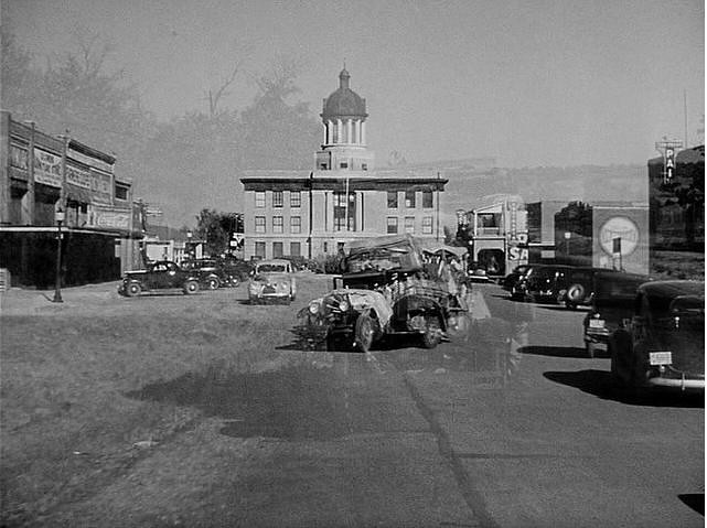
At the intersection of North East Highway 66, you turn right and head west into Sayre, Oklahoma until you hit North 4th Street, or US 283. Here, you turn left and head south on North 4th Street. We drove into downtown to get some pictures of the courthouse, which was made famous in the movie, The Grapes of Wrath.

http://www.sayrechamber.com/index.html
http://en.wikipedia.org/wiki/Sayre,_Oklahoma
Saturday, October 20, 2012 17:59:29
http://www.sayrechamber.com/index.html
http://en.wikipedia.org/wiki/Sayre,_Oklahoma
Saturday, October 20, 2012 17:59:29
 |
| Sayre, Oklahoma |
Saturday, October 20, 2012 17:59:34
 |
| Sayre, Oklahoma |
Saturday, October 20, 2012 17:59:39
 |
| Sayre, Oklahoma |
Saturday, October 20, 2012 18:00:22

Saturday, October 20, 2012 18:00:37

Saturday, October 20, 2012 18:00:41

Saturday, October 20, 2012 18:00:47

Saturday, October 20, 2012 18:00:51

Saturday, October 20, 2012 18:00:58


Saturday, October 20, 2012 18:02:38

Saturday, October 20, 2012 18:03:08

Saturday, October 20, 2012 18:03:58
 |
| US 283, South of Sayre, Oklahoma |
At Beckham County road Q, you turn left. You continue west to Beckham County road 21, you turn left and head south until you hit Beckham County Road R, which is the north outer road of I-40. West of here, you hit a portion that was at one time 4 lane divided highway. In many parts the north lanes are abandoned and returning to nature. For some reason, the gps guided us south on Beckham County Road 15.
Saturday, October 20, 2012 18:14:14
Saturday, October 20, 2012 18:14:14
 |
| 4 lane divided highway with the north lanes abandoned in Beckham County, Oklahoma. |
Saturday, October 20, 2012 18:14:18

We were detoured on the north outer road of the higway, then back onto East 1230 road, which is the same road we were on. However, the north lanes of the divided highway are open. You cross under I-40 into Erick, Oklahoma.
Saturday, October 20, 2012 18:18:12
Saturday, October 20, 2012 18:18:12

Oct 20, 2012 6:18:18 PM
Erick, OK 73645, USA
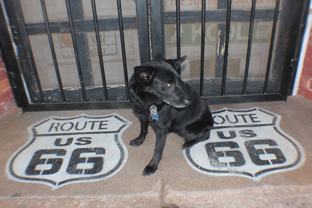
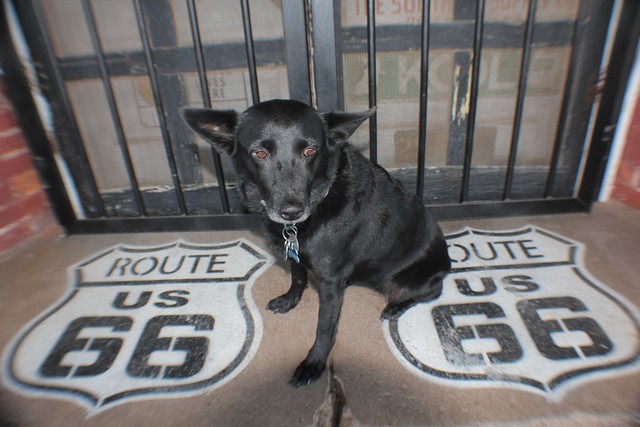
Saturday, October 20, 2012 18:23:30
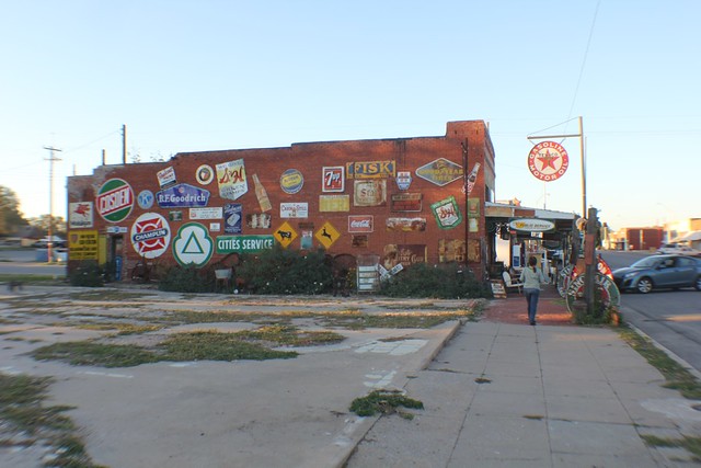
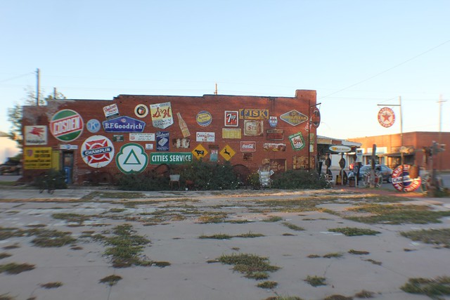
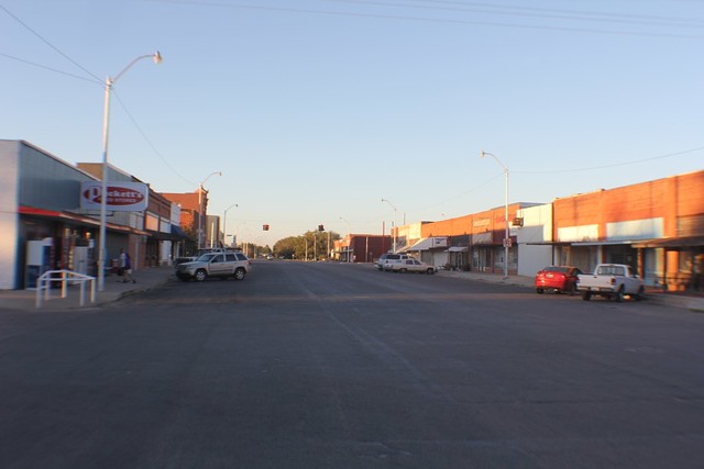
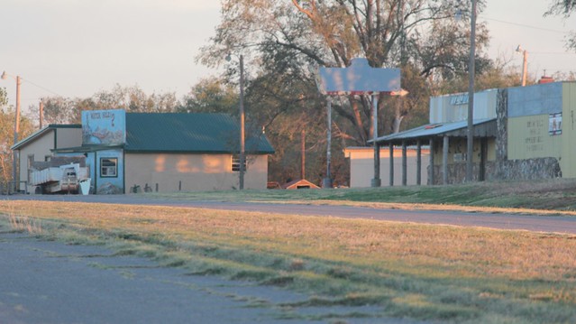
 |
| Downtown Erick, Oklahoma |
Saturday, October 20, 2012 18:23:50
 |
| Downtown Erick, Oklahoma |
Saturday, October 20, 2012 18:24:00
 |
| Downtown Erick, Oklahoma |
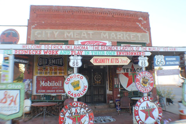
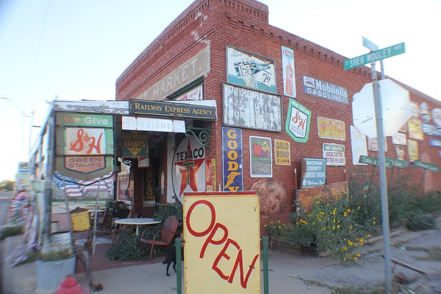
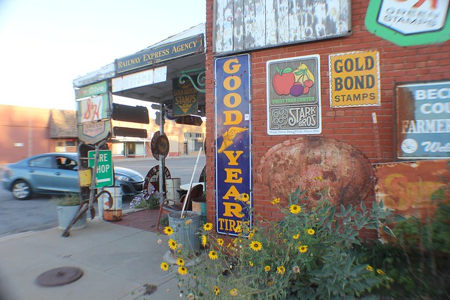
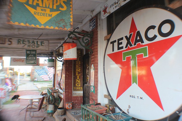
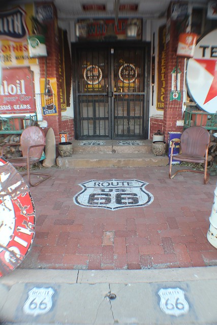
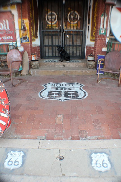
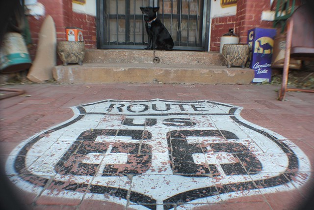
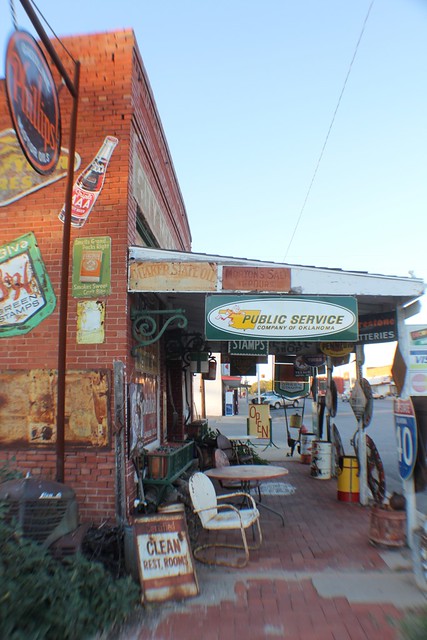
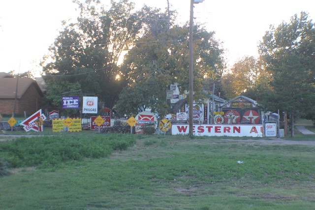
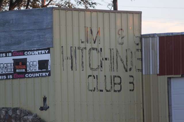
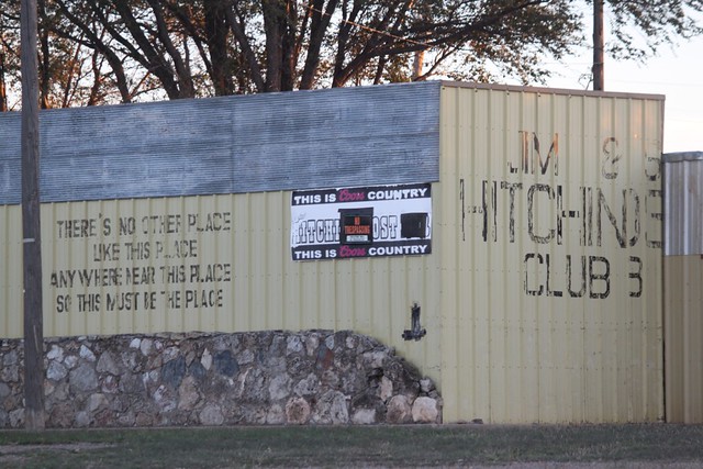
We came here to visit the Sandhills Curiosity Shop. Alas, our road Karma was yet bad, and we got here too late for it to be open. We took some pictures.
http://harleyandannabelle.blogspot.com/
Saturday, October 20, 2012 18:24:16
http://harleyandannabelle.blogspot.com/
Saturday, October 20, 2012 18:24:16

Saturday, October 20, 2012 18:27:19
Saturday, October 20, 2012 18:27:54
Saturday, October 20, 2012 18:28:14
Saturday, October 20, 2012 18:28:33
Saturday, October 20, 2012 18:28:54
Saturday, October 20, 2012 18:29:45
Saturday, October 20, 2012 18:30:12
Saturday, October 20, 2012 18:30:31
Saturday, October 20, 2012 18:30:53
Saturday, October 20, 2012 18:31:53
Saturday, October 20, 2012 18:32:23
Saturday, October 20, 2012 18:32:52
Saturday, October 20, 2012 18:33:29
Saturday, October 20, 2012 18:33:41
- 2012/10/20 Saturday 18:33
Erick Police Department
1 (580) 526-3385
204 S Sheb Wooley , Erick, OK 73645, 73645
View Larger Map
Saturday, October 20, 2012 18:34:18
Saturday, October 20, 2012 18:34:18
 |
| Downtown Erick Oklahoma |

Saturday, October 20, 2012 18:34:27

Saturday, October 20, 2012 18:34:38

Saturday, October 20, 2012 18:34:49

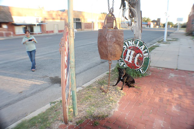
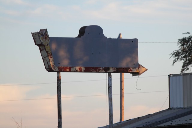
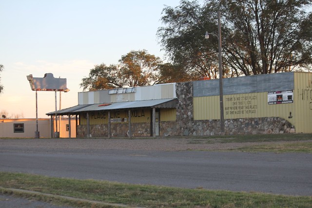
We passed through Erick, Oklahoma after taking the two block detour south to visit Harley and Annabelles shop. In the gold twilight late October sun, we took this old forgotten portion of 4 lane highway to the near ghost town of Texola, Oklahoma.
Saturday, October 20, 2012 18:38:30
Saturday, October 20, 2012 18:38:30

Saturday, October 20, 2012 18:38:42

Saturday, October 20, 2012 18:40:00

Saturday, October 20, 2012 18:40:57


Saturday, October 20, 2012 18:43:18

Saturday, October 20, 2012 18:43:24

Saturday, October 20, 2012 18:50:33
Saturday, October 20, 2012 18:53:34
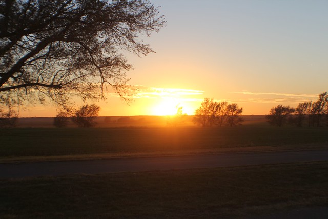
Texola, Oklahoma/Texas, Route 66.
Saturday, October 20, 2012 18:53:45

Saturday, October 20, 2012 18:53:48
Saturday, October 20, 2012 18:53:51
Saturday, October 20, 2012 18:54:27
We watched the sunset, and bid adieu to Oklahoma.
Saturday, October 20, 2012 18:56:07

Saturday, October 20, 2012 19:04:10

Saturday, October 20, 2012 18:04:35
Saturday, October 20, 2012 18:04:38
Saturday, October 20, 2012 18:04:41

Saturday, October 20, 2012 18:04:43
Saturday, October 20, 2012 18:04:49
Saturday, October 20, 2012 18:04:51

*Art Lights the Way


