
20160424 Sunday Route 66 Between Eureka, Missouri and the Chain of Rocks Bridge and Back
Today we decided to finish Route 66 in Missouri, see a bit of St. Louis, then head home. I was initially hoping to follow the course of the National Old Trails Road (NOTR) from east to west across Missouri, but I knew that was unrealistic. There is just not enough time, and as we went across Missouri, I realized that I didn't have an adequate road map that would take me on decent equivalent roads that would closely approximate the course of the NOTR without taking me to a lot of dead ends. So, Missouri NOTR will have to be an adventure for another day or two, or more.
If you want, play this playlist for your listening pleasure...
Eureka, Missouri
We started out today more relaxed than yesterday at the KOA RV park in Eureka, Missouri.

http://koa.com/campgrounds/st-louis-west/


 Our map showed us that we needed to drive up to the next exit and take I-44 Eastward, unfortunately.
 First stop for us -- fuel....


 I thought about visiting the park there. On second thought, I think I'll pass....
 Unfortunately, in this area the Interstate is the only way. I do believe the road in this picture on the right is original route 66.
 After traveling I-44/US 50 quite a ways through some dramatic countryside, the exit for Watson Road/Missouri 366 appears, and we can breathe easier knowing we've made it to the pace and road of our choosing. Matter of fact, this brief journey on the interstate brought us in contact with some road rage directed against us because we weren't driving at least 20 miles per hour over the speed limit.


 Exiting to the promised land....
 ...and what to our road weary eyes should appear but a neon beacon calling us to a better way....
http://www.crestwoodbowl.com
https://www.facebook.com/crestwoodbowl
 We got up fast this morning without a proper breakfast thinking that perhaps we would save our appetite for some road fare. Route 66 does not disappoint!
 This is what would be referred to as a post modern diner....
http://www.courtesydiner.com
Suyen, my wife, learned a little something about a dish called a slinger....
https://en.wikipedia.org/wiki/Slinger
 I had a hankering for panicks (Stevoism for Pan Cakes)
 Post modern made to look like a diner....

 Not quite American Graffiti....
 Yes, we had cawfeeeee, and a refill, so we must head east...
 Duplex Motel -- love the arrow pointing down...
http://www.66postcards.com/postcards/mo/MO024300.html
 according to http://www.route66news.com/2007/05/25/wayside-motel/ this place is across the street from the site of the Coral Courts.
 Love that Rothman sign....
http://www.rothmanfurniture.com
 Ship it on the Frisco!
http://www.american-rails.com/the-frisco.html


 Ted Drewes from September 2012
 Follow Missouri 366, or Chippewa Street, until it comes to an x intersection with Missouri 30, otherwise known as Gravois Avenue... turn left on Gravois to head to the Northeast into St. Louis.


 Intersection of Chippewa (MO 366) and Gravois (MO 30). We will be swinging left in this x intersection.


 St. Louis is very confusing if you want to follow 66. Alignments changed a lot in the city. Therein lies the challenge and the reward, as there are many places to explore in this city. Just be conscious and aware of your surroundings as in any highly concentrated urban area.
 There are many beautiful old buildings in this city.


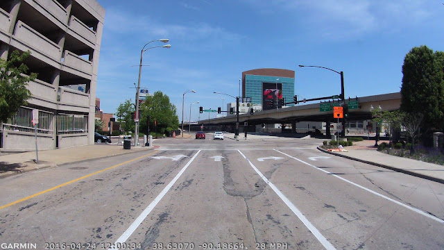
 Our map showed us getting on the interstate where Missouri 30 crosses over I-44, and then staying on the interstate until the exit off I-70 towards the northern part of the city. We wanted to explore the riverfront/downtown, so we continued on this route. As I re-examine another map, I see that we pretty much stayed on old 66 until we got downtown.
 Take Missouri 30 (Gravois Street) over the I-44 Overpass. Here it bends more north and bends again northerly and turns into South Tucker Boulevard.

 We broke karma with the road at Market street to go downtown. Please note that you can never really break karma with the road as long as you stay in the spirit.
 Market is a main east west artery. If we turned to the west, we would pass Union Station. If you head east, well, it is obvious what you would run into...
McDonalds...
....arguable one of the largest googie landmarks ever!


 St Louis is not the most visiter friendly city to visit as you will soon find out if you try to navigate its streets.


 Our goal was to make it to Lacledes landing. Now, the arch is great and all, but one of the things that really pisses me off is what past generations referred to as "urban renewal." Their idea back then was to tear everything down then overpay developers to build costly and oftentimes ugly modern structures to replace what was plowed under with little regard to what was there before. In most cases, it didn't take long for the new modern structures to become archaic. Also many of those structures had very little flexibility as far as use, and were very beholden to the automobile over everything else. So, their useful life was about 25 years or so, before they too had to be replaced. We see many examples of this over the American landscape. Don't get me wrong, the Jefferson Expansion Memorial Arch is timeless, one of the few successful examples. However, if you look at the area around the arch, you will find that it would have been better if the developers had spared at least a little of the surrounding neighborhoods. Lacledes Landing is the tiny reservation of what once stood in the arches footprint. One of the plans for the arch was to not tear everything down, but to preserve a lot of it. It gets worse than that, though, as the wholesale destruction of the area took place in 1940, and the area sat ugly and empty for more than 20 years.
https://www.cnu.org/highways-boulevards/campaign-cities/saint-louis


 We were going to walk to the arch to take pictures. It seems these days there is not much in Lacledes Landing -- just sports bars, a casino and lots of empty old buildings.
 We found our way to the riverfront blocked. So we, and a whole bunch of other lost tourists had to find the only way to the arch. There seemed to be no guides, written or human that indicated which way we needed to go. We were not the only ones in this predicament.


 Every way we try to go to the arch is blocked. Forget about making it to the river front from here.
 The arch is undergoing major renovations.
 Could this sign be an attempt at guiding lost souls to the arch?
 We made it to the best vantage we are going to get apparently.


 Plenty of dog lovers here...


 After some pix, we headed back. Not really worth the $6.00 parking.
 Imagine if we didn't flatten everything as a memorial to the past....

 Getting out was confusing to us.


 We ended up making a wrong turn into East St. Louis. I think they based part of a movie off that...
https://youtu.be/hwBoa-NbNL8
http://wikitravel.org/en/East_St._Louis
 A glimpse of the apocalypse that is East St. Louis...
 Back across the "stan span"


 North on I-70 and back on track, sort of...


 Exiting to North Florissant Avenue
 Turn right from North Florissant to head northeast on Calvary Avenue and to get a fascinating tour of a huge cemetery...


 Calvary Cemetery

 Calvary Avenue swings northeast on the Calvary Avenue ramp which connects with North Broadway, which will take you through some really old but very run down neighborhoods.


 The googie vector on the left sort of reminds me of another famous vector on route 66...
http://www.il66assoc.org/content/vic-suhling-neon-sign-shine-again
 Take North Broadway to Riverview Drive, and turn right on Riverview to head northeast..


 On the left is a fence made of steel sheets and cement mixer truck drums...
 Passing Riverfront Park, which used to be an amusement park...
http://www.forestparkhighlands.com/chainofrocks.html
 Illinois
From Riverview Drive, we cross over the Mississippi River via the I-270 Bridge, which replaced the Chain of Rocks Bridge as a passage.
https://en.wikipedia.org/wiki/New_Chain_of_Rocks_Bridge


 To finish traveling route 66 in Missouri, you must travel to Illinois. Only after crossing can you finish the last part of the trek, on foot....
Take I-270 eastbound to the Illinois 3 exit, and head south. You will pick up 66, or Chain of Rocks road, as the next left to head west towards the bridge.
This area is sort of run down.
No name on the motel with a great sign, but the marquee says TT's Bar. I looked it up and found nothing. The place looks really run down.
 To get to the Chain of Rocks Bridge, you cross a one lane bridge to an island.
 I think the other lane is reserved for bicycles.

 Beautiful portion of Portland route 66.

 Here is as far as you can go west by car. The rest is by foot.
 Chain of Rocks Bridge Across the Mississippi River


 Chain of Rocks Bridge from September 2012
 Just as it was with our dog, Tima, back in 2012 (Tima passed away in February 2015) we have a mission to take our other dogs on all of route 66. Stella has been from Chicago to Oatman Arizona. Jimmy has been from Northeast Oklahoma to here -- Chain of Rocks.
Jimmy and Stella and the Chain of Rocks Bridge

 The graffiti has gotten worse...


 Heading Back
We had no more time to drive the route of the National Old Trails Road (NOTR, so instead, I followed it along as I passed it on I-70. As you look at the screen grabs, the orange line is the approximate location of the NOTR.


http://www.archive.org/stream/nationaloldtrail00autorich#page/n63/mode/2up


Here is a Svoboda Link to a previous trip on the western Missouri Part of the NOTR...

http://svobodakc.blogspot.com/2015/04/vacation-from-our-vacation-along-notr.html


 Watch the orange line as it zig zags around the present routes....


Today we decided to finish Route 66 in Missouri, see a bit of St. Louis, then head home. I was initially hoping to follow the course of the National Old Trails Road (NOTR) from east to west across Missouri, but I knew that was unrealistic. There is just not enough time, and as we went across Missouri, I realized that I didn't have an adequate road map that would take me on decent equivalent roads that would closely approximate the course of the NOTR without taking me to a lot of dead ends. So, Missouri NOTR will have to be an adventure for another day or two, or more.
If you want, play this playlist for your listening pleasure...
Eureka, Missouri
We started out today more relaxed than yesterday at the KOA RV park in Eureka, Missouri.
http://koa.com/campgrounds/st-louis-west/
Eureka, Missouri
From Wikipedia, the free encyclopedia
Times Beach, Missouri
From Wikipedia, the free encyclopedia
Bet you didn't know, did you?
http://www.crestwoodbowl.com
https://www.facebook.com/crestwoodbowl
http://www.courtesydiner.com
Suyen, my wife, learned a little something about a dish called a slinger....
https://en.wikipedia.org/wiki/Slinger
Melba looks great, doesn't she?
http://www.66postcards.com/postcards/mo/MO024300.html
http://www.rothmanfurniture.com
http://www.american-rails.com/the-frisco.html

St. Louis
From Wikipedia, the free encyclopedia
McDonalds...
....arguable one of the largest googie landmarks ever!
https://www.cnu.org/highways-boulevards/campaign-cities/saint-louis
We finally found parking at Lacledes landing, with a very in attendant attendant taking our money.
https://youtu.be/hwBoa-NbNL8
http://wikitravel.org/en/East_St._Louis
East St. Louis, Illinois
From Wikipedia, the free encyclopedia
Don't get me wrong here, we only just crossed the new Interstate bridge and offed and oned. We didn't cruise downtown East St. Louis, (this time). We have a friend who used to attend Parks Air College. He says he used to ride his bike through East St. Louis with no problems. We crossed back over, and took I-70 northwest to the North Florissant Avenue exit that would deposit us back on route 66.
http://www.il66assoc.org/content/vic-suhling-neon-sign-shine-again
http://www.forestparkhighlands.com/chainofrocks.html
From Riverview Drive, we cross over the Mississippi River via the I-270 Bridge, which replaced the Chain of Rocks Bridge as a passage.
https://en.wikipedia.org/wiki/New_Chain_of_Rocks_Bridge

Take I-270 eastbound to the Illinois 3 exit, and head south. You will pick up 66, or Chain of Rocks road, as the next left to head west towards the bridge.
This area is sort of run down.
Madison, Illinois
From Wikipedia, the free encyclopedia
Jimmy and Stella and the Chain of Rocks Bridge
We had no more time to drive the route of the National Old Trails Road (NOTR, so instead, I followed it along as I passed it on I-70. As you look at the screen grabs, the orange line is the approximate location of the NOTR.


http://www.archive.org/stream/nationaloldtrail00autorich#page/n63/mode/2up


Here is a Svoboda Link to a previous trip on the western Missouri Part of the NOTR...
http://svobodakc.blogspot.com/2015/04/vacation-from-our-vacation-along-notr.html